Your drone won’t automatically stop you from entering restricted airspace starting January 13, 2025. That red zone on your DJI drone restriction map that once blocked flight now only flashes warnings—putting full legal responsibility on your shoulders. This seismic shift transforms Restricted Zones into Enhanced Warning Zones where you decide whether to override, making map literacy non-negotiable for compliant flight. Without understanding DJI’s color-coded system and unlock workflows, you risk FAA fines up to $32,666 per violation or worse. This guide cuts through the confusion with actionable steps to legally navigate any airspace using the updated DJI drone restriction map.
Decoding DJI’s Four Geo Zone Colors (2025 Update)

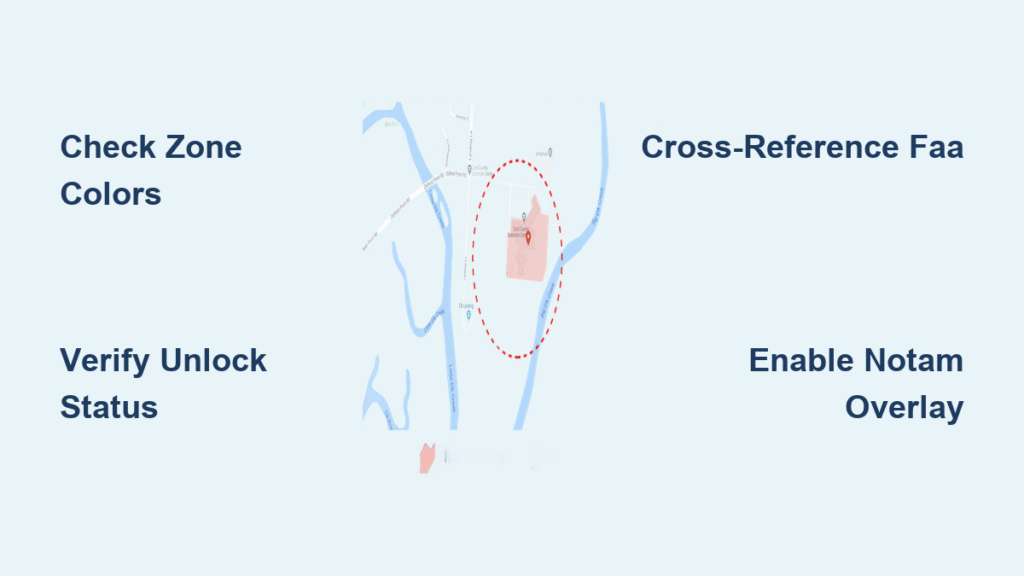
Red Restricted Zones: Critical Infrastructure Flight Rules
Red zones now display orange stripes on your map but still guard airports’ runway approaches, prisons, and nuclear facilities. Unlike pre-2025 when flight was physically blocked, you’ll now see “Enhanced Warning: Restricted Zone” with audible alerts—but can override. Never proceed without Custom Unlock approval; these require FAA authorization documents. If your map shows saturated red, you’re within the zone boundary where altitude restrictions (often 0-400ft) apply. Override here without authorization risks immediate FAA enforcement.
Blue Authorization Zones: Airport Boundary Protocols
Blue zones cover airport outer rings and controlled airspace where Self Unlock suffices. Your DJI Fly app will prompt “Flight in Authorization Zone detected” with options to override or unlock. Complete Self Unlock before takeoff using SMS or credit card verification—this expires 24-48 hours post-approval. Look for pale blue when planning flights; saturated blue means your drone is already inside the zone. Pro pilots use the CSC maneuver (both sticks pushed inward/down) to force detection if the prompt doesn’t auto-appear.
Orange Stripe Enhanced Warning Zones Explained
These new zones target stadiums during events, wildfire operations, or presidential movements. Unlike red zones, no unlock is ever required—but overriding means assuming full risk. The map shows distinctive orange stripes with altitude ceilings (e.g., “0-150ft”). When active, your drone displays flashing warnings and the telemetry bar shows real-time distance to boundaries. Always cross-reference with FAA’s NOTAM system; these zones activate with zero notice during emergencies.
Yellow Warning Zones: When to Proceed with Caution
Yellow zones indicate general caution areas like helipads or Class G airspace near airports. No unlock needed, but visual warnings persist during flight. These never block operation but require heightened awareness. If your map shows pale yellow during planning, check local ordinances—some parks ban drones entirely despite no FAA restriction. Yellow zones intensify to solid color only when your drone enters the boundary.
How to Access the DJI Restriction Map in 2025
DJI Fly App Navigation Shortcuts for Real-Time Checks
Launch DJI Fly, tap your aircraft icon, then navigate: Safety → Geo Zones. Verify your exact location using the real-time positioning dot before takeoff—cellular dead zones cause false negatives. Enable all layer toggles (NOTAM, satellite view) for maximum accuracy. Pro tip: On iOS, use Safari’s “Request Desktop Site” to access full web unlock features when the app malfunctions. Always confirm the status bar shows a green padlock (Self Unlock) or gold shield (Custom Unlock).
Web Portal Method for Pre-Flight Mission Planning
Visit dji.com/flysafe/geo-map on desktop to plan missions 24+ hours ahead. Enter precise coordinates—not just city names—as zone boundaries shift within 500 feet. Click any colored polygon to see critical details: “Restricted Zone: 0-400ft ceiling, radius 1.2mi.” Download offline maps via Settings → Map Management for areas with poor signal. Cross-check with faadronezone.faa.gov for LAANC-enabled airspace; DJI zones don’t cover all regulatory boundaries.
Step-by-Step: Unlocking Blue Zones with Self Unlock
Pre-Flight Web Unlock Procedure (24-48 Hour Window)
Go to dji.com/flysafe/self-unlock, select your drone model, and drop a pin on your exact flight location. Submit 48 hours early—approvals often take 24 hours. The confirmation screen shows your unlock radius (typically 0.25-1.5 miles) and expiration time. Sync tokens while connected to Wi-Fi before departure; cellular sync fails 30% of the time according to DJI’s support logs. Never reuse tokens—each flight requires a new unlock.
On-Site App Unlock When You Forgot to Plan Ahead
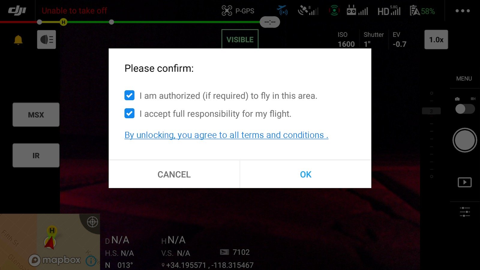
Power on your drone at the location, wait for the blue zone prompt, then tap “Yes.” Verify identity via SMS (not credit card) for fastest approval—credit card checks add 10+ minutes. If no prompt appears, perform the CSC maneuver immediately. Critical: The unlock only works for that specific controller serial number. Check it via Aircraft → Settings → About → Flight Controller Serial Number before submitting requests.
Custom Unlock Process for Red Restricted Zones
Required Documents Checklist for FAA Compliance
Custom Unlock demands proof of authorization: Part 107 certificate, LAANC approval, or FAA COA/Waiver. For critical infrastructure (power plants, military bases), add written facility permission. Upload PDFs showing your name matching the DJI account. Rejection reason #1: Blurry documents. Submit crisp scans with visible expiration dates. Stadium TFRs require event-specific authorization—generic waivers won’t suffice.
Submitting Your Custom Unlock Request Correctly
At dji.com/flysafe/custom-unlock, enter exact UTC operation times (not local time). Mission descriptions like “cell tower inspection” get approved faster than “aerial photography.” Processing takes 1-3 business days—weekend submissions delay approvals. When importing the .dat token file, ensure your drone controller is powered on. Tokens fail if firmware updates occur post-approval; re-sync after any update.
2025 Policy Change: What Pilots Must Know Now
Why DJI Removed Automatic Flight Blocking
DJI shifted responsibility to pilots after FAA clarified that geofencing isn’t legally binding. Your drone now obeys your commands, not airspace rules—meaning you’re liable even if the map glitches. This change aligns with global regulations where pilots must self-verify airspace status. Remember: The DJI drone restriction map shows technical possibilities, but FAA regulations determine legal flight.
Legal Consequences of Ignoring Warning Zones
Overriding red/orange zones without authorization risks $30,000+ FAA fines and criminal charges near critical infrastructure. In 2024, a photographer flying over a wildfire zone faced 6 months in jail. DJI’s system change doesn’t alter FAA rules—restricted airspace remains illegal to enter. Your flight log data becomes evidence; never assume “no block = permission.”
Troubleshooting Map and Unlock Failures
Fixing “Phantom Zone” False Positives
When the map shows clear airspace but flight is blocked, enable the NOTAM/TFR overlay layer—80% of “phantom zones” are active temporary restrictions. Refresh map data by force-closing the DJI Fly app. If issues persist, check dji.com/flysafe/geo-map on desktop; app caches often corrupt during updates. Never fly if boundaries appear inconsistent between devices.
Resolving Serial Number and Token Sync Errors
Token failures usually trace to wrong serial numbers. The flight controller serial (not aircraft serial) is required—it’s 14 characters starting with “C.” Common mistakes: confusing “0” with “O” or “B” with “8.” If tokens won’t load, clear app cache via Settings → Apps → DJI Fly → Storage → Clear Data. For international travel, create a local-region DJI account; unlock databases are geo-fenced.
Pre-Flight Compliance Checklist for Restricted Airspace
- [ ] Verify zone colors on both web portal and app 1 hour pre-flight
- [ ] Confirm unlock token is synced (green padlock/gold shield visible)
- [ ] Cross-check with FAA DroneZone for LAANC status
- [ ] Download offline maps if flying beyond cell coverage
- [ ] Brief visual observer on boundary locations using telemetry bar
- [ ] Carry printed authorization documents for red zones
- [ ] Check weather overlay—high winds trigger temporary TFRs
Maintaining Unlock Tokens and Long-Term Management
Custom Unlock tokens expire exactly at your specified UTC end time—no grace period. Self Unlocks last 24-48 hours but invalidate after firmware updates; always re-apply tokens post-update. For multi-battery missions, never switch controllers—tokens bind to specific serial numbers. Back up .dat files to cloud storage; losing them means restarting the 3-day approval process. When traveling internationally, anticipate 48-hour delays for region-specific unlocks.
Mastering the DJI drone restriction map after January 2025 means accepting absolute responsibility for airspace compliance. Red zones no longer stop your drone—they warn you to stop yourself. Always triple-check zones via web portal, app, and FAA sources before takeoff. Carry physical proof of authorization in red zones, and never override orange stripes during emergencies. Remember: That override button isn’t permission—it’s a legal liability switch. When your drone asks “Proceed anyway?”, the only safe answer is “Only if I have documentation.” The sky stays open only when pilots respect its boundaries.